All Products

Languages of South Asia- Konkani
·Type: Maps ·Map Date: February 2008 ·Data Source: Census Information, UNESCO (1987) through UNEP/GRID-Sioux Falls ·Producer: Global Mapping International and The Joshua Project ·Size: 11.7 by 8.27 inches,...

Languages of South Asia- Kutchi
·Type: Maps ·Map Date: February 2008 ·Data Source: Census Information, UNESCO (1987) through UNEP/GRID-Sioux Falls ·Producer: Global Mapping International and The Joshua Project ·Size: 11.7 by 8.27 inches,...

Languages of South Asia- Maithili
·Type: Maps ·Map Date: February 2008 ·Data Source: Census Information, UNESCO (1987) through UNEP/GRID-Sioux Falls ·Producer: Global Mapping International and The Joshua Project ·Size: 11.7 by 8.27 inches,...

Languages of South Asia- Malayalam
·Type: Maps ·Map Date: February 2008 ·Data Source: Census Information, UNESCO (1987) through UNEP/GRID-Sioux Falls ·Producer: Global Mapping International and The Joshua Project ·Size: 11.7 by 8.27 inches,...

Languages of South Asia- Marathi
·Type: Maps ·Map Date: February 2008 ·Data Source: Census Information, UNESCO (1987) through UNEP/GRID-Sioux Falls ·Producer: Global Mapping International and The Joshua Project ·Size: 11.7 by 8.27 inches,...

Languages of South Asia- Meitei
·Type: Maps ·Map Date: February 2008 ·Data Source: Census Information, UNESCO (1987) through UNEP/GRID-Sioux Falls ·Producer: Global Mapping International and The Joshua Project ·Size: 11.7 by 8.27 inches,...
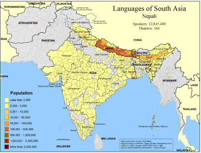
Languages of South Asia- Nepali
·Type: Maps ·Map Date: February 2008 ·Data Source: Census Information, UNESCO (1987) through UNEP/GRID-Sioux Falls ·Producer: Global Mapping International and The Joshua Project ·Size: 11.7 by 8.27 inches,...
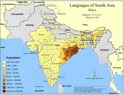
Languages of South Asia- Oriya
·Type: Maps ·Map Date: February 2008 ·Data Source: Census Information, UNESCO (1987) through UNEP/GRID-Sioux Falls ·Producer: Global Mapping International and The Joshua Project ·Size: 11.7 by 8.27 inches,...
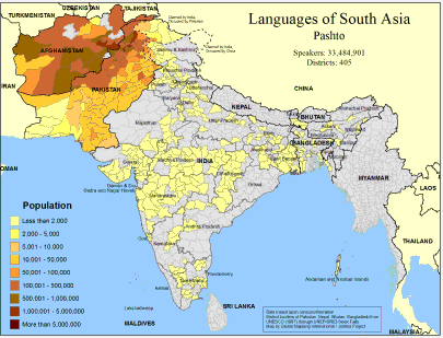
Languages of South Asia- Pashto
·Type: Maps ·Map Date: February 2008 ·Data Source: Census Information, UNESCO (1987) through UNEP/GRID-Sioux Falls ·Producer: Global Mapping International and The Joshua Project ·Size: 11.7 by 8.27 inches,...

Languages of South Asia- Punjabi
·Type: Maps ·Map Date: February 2008 ·Data Source: Census Information, UNESCO (1987) through UNEP/GRID-Sioux Falls ·Producer: Global Mapping International and The Joshua Project ·Size: 11.7 by 8.27 inches,...
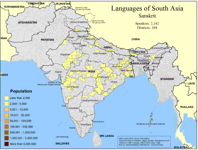
Languages of South Asia- Sanskrit
·Type: Maps ·Map Date: February 2008 ·Data Source: Census Information, UNESCO (1987) through UNEP/GRID-Sioux Falls ·Producer: Global Mapping International and The Joshua Project ·Size: 11.7 by 8.27 inches,...
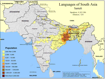
Languages of South Asia- Santali
·Type: Maps ·Map Date: February 2008 ·Data Source: Census Information, UNESCO (1987) through UNEP/GRID-Sioux Falls ·Producer: Global Mapping International and The Joshua Project ·Size: 11.7 by 8.27 inches,...
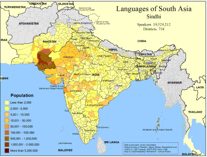
Languages of South Asia- Sindhi
·Type: Maps ·Map Date: February 2008 ·Data Source: Census Information, UNESCO (1987) through UNEP/GRID-Sioux Falls ·Producer: Global Mapping International and The Joshua Project ·Size: 11.7 by 8.27 inches,...
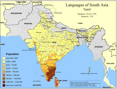
Languages of South Asia- Tamil
·Type: Maps ·Map Date: February 2008 ·Data Source: Census Information, UNESCO (1987) through UNEP/GRID-Sioux Falls ·Producer: Global Mapping International and The Joshua Project ·Size: 11.7 by 8.27 inches,...
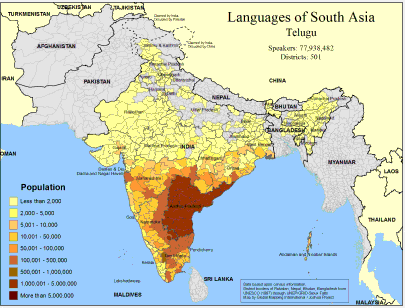
Languages of South Asia- Telugu
·Type: Maps ·Map Date: February 2008 ·Data Source: Census Information, UNESCO (1987) through UNEP/GRID-Sioux Falls ·Producer: Global Mapping International and The Joshua Project ·Size: 11.7 by 8.27 inches,...
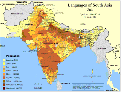
Languages of South Asia- Urdu
·Type: Maps ·Map Date: February 2008 ·Data Source: Census Information, UNESCO (1987) through UNEP/GRID-Sioux Falls ·Producer: Global Mapping International and The Joshua Project ·Size: 11.7 by 8.27 inches,...

Languages of the World - Cartogram
·Type: Maps ·Description: Countries are sized by number of languages. ·Map Date: 2007 ·Data Source: 15th Edition Ethnologue Producer: Global Mapping International ·Collection: Projects 2007 ·Size: Size: 8...

Languages of Uttar Pradesh State, India
·Type: Maps ·Map Date: 2007 ·Data Source: World Language Mapping Systems ·Producer: GMI ·Collection: Projects 2007 ·Size: 7½ by 10 inches, landscape ·Categories: Type :: Maps Country :: India...
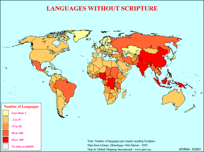
Languages without Scripture
·Type: Maps ·Description: Number of languages without scripture on country level divisions. ·Map Date: 2000 ·Producer: Global Mapping International ·Collection: General World Maps (WV 2002) ·Size: 8½...
Lao PDR (WorldBank)
NOTE: The most recent year's information is shown below. Click on the year to see all years for this indicator. COMMUNICATION2021 4,822,973 Mobile cellular subscriptions2021 62 Individuals using the...

Laos
For a more detailed listing click here Modern-day Laos has its roots in the ancient Lao kingdom of Lan Xang, established in the 14th century under King FA NGUM. For 300 years Lan Xang had influence reaching into present-day Cambodia and Thailand,...
Laos (Joshua Project)
Progress Scale: Partially Reached Population: 7,873,000 Capital: Vientiane % Buddhism: 60.03 % Professing Christian: 3.65 % Evangelical: 2.53 Peoples Count: 188 In 10/40...

Laos (Operation World)
Largest Religion: Buddhist Number People Groups: 134 Number Languages: 89 Official Language: Lao For more information go to Laos on the Operation World website. The above link opens in a new tab.

Laos (Prayercast)
Government: Communist State Major People Groups: Lao-Lu GDP Per Capita: $7,800 Literacy Rate: 84.7% Unreached: 75.8% Population: 7,574,356 Religions: Buddhist, Ethnic religions,...

Larger African Trade Languages
·Type: Maps ·Map Date: July 2004 ·Data Source: Language locations from World Language Mapping System ·Producer: Global Mapping International ·Collection: Projects 2004 ·Size: 8 1/2 by 11 inches, landscape...
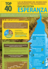
Las 40 regiones del mundo más marginadas y no alcanzadas que nec
Por lo general, cuando se piensa en “la selección de 40” lo que viene a la mente es una lista de las mejores canciones u otros elementos populares que son buscados y apreciados. En un sentido, estos lugares no son diferentes. Dios es un...

Las Culturas en Colores - Luz de Dios (Missio Nexus)
Pasamos mucho tiempo tratando de entender diferencias entre las culturas. Pero ¿cuál es el objetivo final? Cuanto más aprendamos sobre otras culturas, mejor podremos relumbrar el amor de Dios. También, a medida que veamos a Dios a través de...
Late-demographic dividend (WorldBank)
NOTE: The most recent year's information is shown below. Click on the year to see all years for this indicator. COMMUNICATION2022 2,987,085,221 Mobile cellular subscriptions2022 78 Individuals using...

Latin America
·Type: Maps ·Description: Political Map of Latin America ·Map Date: 2002 ·Producer: Global Mapping International ·Collection: Regions (WorldVue 2002) ·Size: 8½ x 11 Inches, landscape...
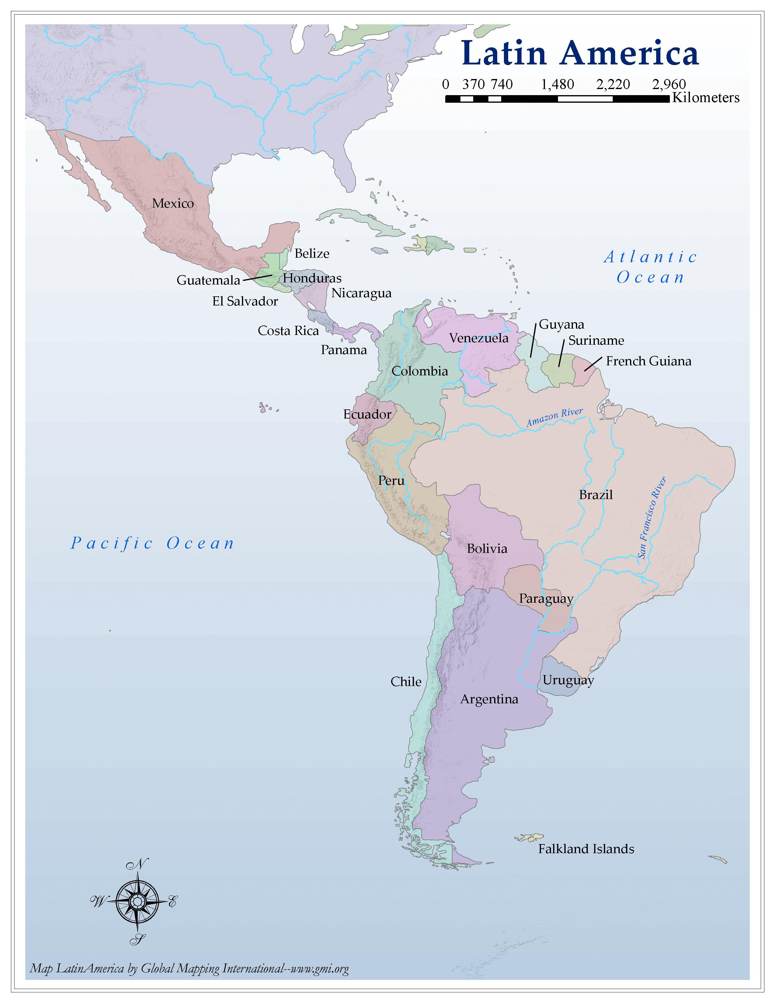
Latin America
·Type: Maps ·Map Date: 2006 ·Producer: Global Mapping International ·Collection: Regions (GMMS 2007) ·Size: 8½ x 11 inches, portrait ·Categories: Type :: Maps Partners :: Global Mapping International...

