All Products

Distribution of Missionaries
·Type: Maps ·Description: Country level distributions of missionaries ·Map Date: 2000 ·Producer: Global Mapping International ·Collection: General World Maps (WV 2002) ·Size: 8½ x 11 Inches,...

Distribution of Muslims
·Type: Maps ·Description: Distribution of Muslims ·Map Date: 2000 ·Producer: Global Mapping International ·Collection: The World of Islam (WV 2002) ·Size: 8½ x 11 Inches, landscape...
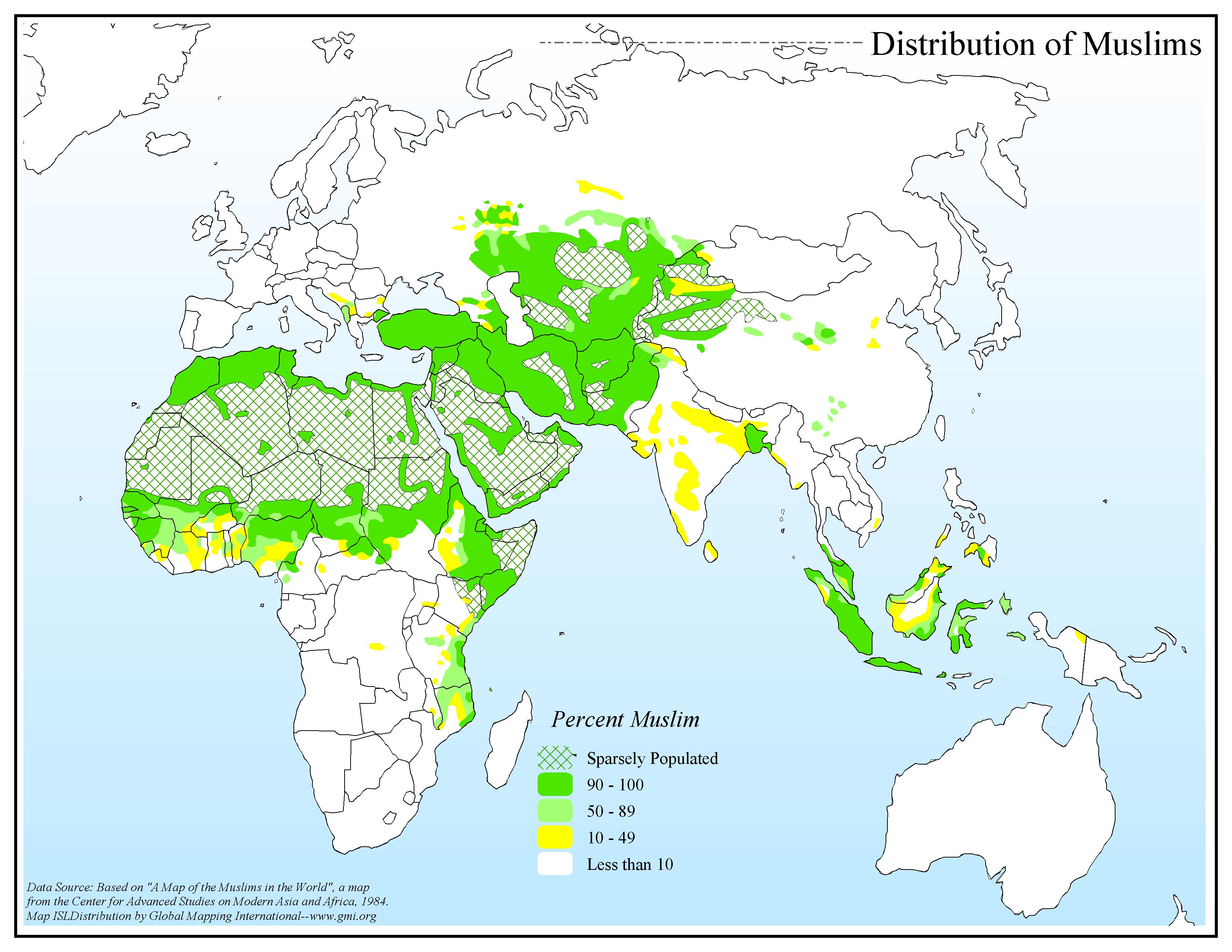
Distribution of Muslims
·Type: Maps ·Map Date: 2006 ·Data Source: Center for Advanced Studies on Modern Asia and Africa, 1984. ·Producer: Global Mapping International ·Collection: The World of Islam (GMMS 2007) ·Size: 8½ x...

Distribution of Muslims (BW)
·Type: Maps ·Description: Distribution of Muslims ·Map Date: 2002 ·Producer: Global Mapping International ·Collection: The World of Islam (WV 2002) ·Size: 8½ x 11 Inches, landscape...

Distribution of Recordings
·Type: Maps ·Map Date: 2006 ·Data Source: Gospel Recordings, 2006 ·Producer: Global Mapping International ·Collection: General World Maps (GMMS 2007) ·Size: 8½ x 11 inches, landscape...

Distribution of Sunni and Shia Muslims
·Type: Maps ·Description: Distribution of Sunni and Shia Muslims ·Map Date: 2000 ·Producer: Global Mapping International ·Collection: The World of Islam (WV 2002) ·Size: 8½ x 11 Inches, landscape...
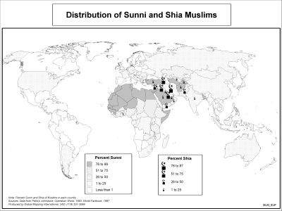
Distribution of Sunni and Shia Muslims (BW)
·Type: Maps ·Description: Distribution of Sunni and Shia Muslims ·Map Date: 2002 ·Producer: Global Mapping International ·Collection: The World of Islam (WV 2002) ·Size: 8½ x 11 Inches, landscape...

Djibouti
For a more detailed listing click here The region of present-day Djibouti was the site of the medieval Ifat and Adal Sultanates. In the late 19th century, treaties signed by the ruling Somali and Afar sultans with the French allowed the latter to...
Djibouti (Joshua Project)
Progress Scale: Unreached Population: 1,184,000 Capital: Djibouti % Islam: 96.22 % Professing Christian: 2.40 % Evangelical: 0.10 Peoples Count: 11 In 10/40 Window:...
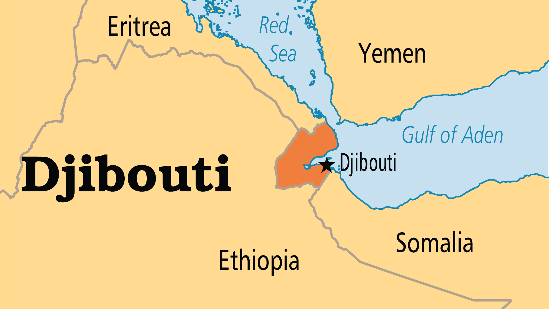
Djibouti (Operation World)
Largest Religion: Muslim Number People Groups: 11 Number Languages: 10 Official Language: French and Arabic. Trade languages Somali, Afar For more information go to Djibouti on the Operation World website. The above...

Djibouti (Prayercast)
Government: Presidential Republic Major People Groups: Somali (Issa), Danakil (Afar), Arab, Eurafrican, French GDP Per Capita: $5,500 Literacy Rate: 67% Unreached: 97.2% Population:...
Djibouti (WorldBank)
NOTE: The most recent year's information is shown below. Click on the year to see all years for this indicator. COMMUNICATION2022 519,258 Mobile cellular subscriptions2021 69 Individuals using the...
Do You Ever Wonder? (Jesus Film)
Have you ever felt like the world was broken, and that we are broken along with it? But there is Good News: God, in His love, has made a way for us to be restored and reconciled. For more information go to Do You Ever Wonder? on the Jesus Film...

Do you Know Who is Visiting Your Site? (Missio Nexus)
So many times we do not truly understand the needs and motivations of those we are trying to serve. This is even truer when it comes to online communications. If more people are going to get plugged into God’s mission, agencies have to...
Do You Understand What You Are Reading?
Toward a Faithful Evangelical Hermeneutic of Scripture Evangelical Unity in Diversity ‘Do you understand what you are reading?’ is Philip’s question to the Ethiopian official who is poring over Isaiah 53:7–8 (Acts 8:27–33). The Ethiopian...

Dominica
For a more detailed listing click here Dominica was the last of the Caribbean islands to be colonized by Europeans due chiefly to the fierce resistance of the native Caribs. France ceded possession to Great Britain in 1763, which colonized the...
Dominica (Joshua Project)
Progress Scale: Significantly Reached Population: 66,000 Capital: Roseau % Professing Christian: 92.10 % Evangelical: 18.12 Peoples Count: 7 In 10/40 Window: N Region:...

Dominica (Operation World)
Largest Religion: Christian Number People Groups: 7 Number Languages: 3 Official Language: nglish, but as many as 80% speak a French Creole For more information go to Dominica on the Operation World website. The...

Dominica (Prayercast)
Government: Presidential Republic Major People Groups: ominican Mulatto, Dominican White, Dominican Black, Haitian Black, Spaniard GDP Per Capita: $17,000 Literacy Rate: 93.8% Unreached:...
Dominica (WorldBank)
NOTE: The most recent year's information is shown below. Click on the year to see all years for this indicator. COMMUNICATION2021 62,171 Mobile cellular subscriptions2021 81 Individuals using the...

Dominican Republic
For a more detailed listing click here The Taino - indigenous inhabitants of Hispaniola prior to the arrival of the Europeans - divided the island into five chiefdoms and territories. Christopher COLUMBUS explored and claimed the island on his...

Dominican Republic (Joshua Project)
Progress Scale: Significantly Reached Population: 11,520,000 Capital: Santo Domingo % Professing Christian: 93.81 % Evangelical: 10.90 Peoples Count: 13 In 10/40 Window:...

Dominican Republic (Operation World)
Largest Religion: Christian Number People Groups: 15 Number Languages: 8 Official Language: Spanish For more information go to Dominican Republic on the Operation World website. The above link opens in a new tab.

Dominican Republic (Prayercast)
Government: Presidential Republic Major People Groups: Dominican Mulatto, Dominican White, Dominican Black, Haitian Black, Spaniard GDP Per Capita: $17,000 Literacy Rate: 93.8% Unreached:...
Dominican Republic (WorldBank)
NOTE: The most recent year's information is shown below. Click on the year to see all years for this indicator. COMMUNICATION2022 10,149,890 Mobile cellular subscriptions2021 85 Individuals using the...

Doubling Time Based on 1998 Population Figures
·Type: Maps ·Map Date: 2006 ·Data Source: International Data Base--U.S. Census Bureau 1998 ·Producer: Global Mapping International ·Collection: General World Maps (GMMS 2007) ·Size: 8½ x 11 inches,...

Doubling Time Based on 2006 Growth Rates
·Type: Maps ·Map Date: 2006 ·Data Source: Data Derived from The World Factbook, 2006 ·Producer: Global Mapping International ·Collection: Factbook (GMMS 2007) ·Size: 8½ x 11 inches, landscape...
Doxology and Overflow – Ajith Fernando
Everything we need for our abundant life is available to us through what Christ has done. Ajith Fernando unwraps the truths of Ephesians 1 as he delves deeper and deeper into the full picture of our salvation, its outworking, and its wonders that we...

DR Congo (Prayercast)
Government: Semi-Presidential Republic Major People Groups: Leta GDP Per Capita: $1,100 Literacy Rate: 77% Unreached: 0.3% Population: 105,044,646 Religions: Christian, Ethnic...
Druze (Prayercast)
long-time power brokers in the Middle East The Druze religion today is quite distinct from Islam. While some Muslim authorities still classify them as a Muslim sect, most Druze – and Muslims for that matter – do not consider themselves Muslims....

