India
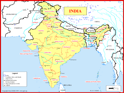
Basemap of India
·Type: Maps ·Description: Political map of India ·Map Date: 1999 ·Producer: Global Mapping International ·Collection: Reaching India (WorldVue 2002) ·Size: 8½ x 11 Inches, landscape ·Note:...
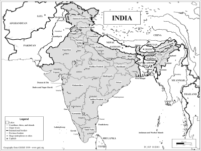
Basemap of India (BW)
·Type: Maps ·Description: Political map of India ·Map Date: 2002 ·Producer: Global Mapping International ·Collection: Reaching India (WorldVue 2002) ·Size: 8½ x 11 Inches, landscape ·Note:...
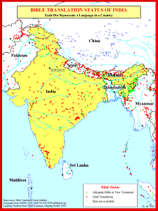
Bible Translation Status of India
·Type: Maps ·Description: Bible Translations of India ·Map Date: 1991 ·Producer: Global Mapping International ·Collection: Reaching India (WorldVue 2002) ·Size: 8½ x 11 Inches, portrait ·Note:...

Bible Translation Status of India (BW)
·Type: Maps ·Description: Bible Translations of India ·Map Date: 2002 ·Producer: Global Mapping International ·Collection: Reaching India (WorldVue 2002) ·Size: 8½ x 11 Inches, portrait ·Note:...

Fishing Where the Fish Are
·Type: Maps ·Description: Fishing Where the Fish Are ·Map Date: 2001 ·Producer: Global Mapping International ·Collection: Missions Minute (WorldVue 2002) ·Size: 8½ x 11 Inches, portrait...

Fishing Where the Fish Are (BW)
·Type: Maps ·Description: Fishing Where the Fish Are ·Map Date: 2002 ·Producer: Global Mapping International ·Collection: Missions Minute (WorldVue 2002) ·Size: 8½ x 11 Inches, portrait...

How India Leaders Make Ministry Decisions (Missio Nexus)
Much of the time we do not think intentionally about how we make decisions in our ministry efforts. This is even truer cross-culturally. If you are an Indian leader, this Missiographic will hopefully provide some perspective on dynamics of decision...

India
·Type: Maps ·Map Date: 2006 ·Producer: Global Mapping International ·Collection: Reaching India (GMMS 2007) ·Size: 8½ x 11 inches, landscape ·Categories: Type :: Maps Continent/Region :: Asia Country...
India (Joshua Project)
Progress Scale: Unreached Population: 1,463,866,000 Capital: New Delhi % Hinduism: 80.06 % Professing Christian: 2.21 % Evangelical: 0.00 Peoples Count: 2272 In 10/40...

India (Operation World)
Largest Religion: Hindu Number People Groups: 2493 Number Languages: 456 Official Language: Constitutionally there are 22 official languages. The official language is Hindi (spoken by 40% of the population). English...

India (Prayercast)
Government: Federal Parliamentary Republic Major People Groups: Bengali, Telugu, Maratha, Tamil, Hindi GDP Per Capita: $6,100 Literacy Rate: 74.4% Unreached: 95.6% Population:...

India (World Factbook website)
Area: 3,287,263 Population: 1,326,093,247 July 2020 est. Life Expectancy: 69.70 Net migration rate: 0.00 2020 est. GDP (real growth rate): 4.86 2019 est. Internet Users: 446,759,327 For more...
India (WorldBank)
NOTE: The most recent year's information is shown below. Click on the year to see all years for this indicator. COMMUNICATION2022 1,142,930,000 Mobile cellular subscriptions2021 46 Individuals using...
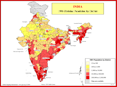
India - 1991 Christian Population by District
·Type: Maps ·Description: 1991 Chrisitian Population by district ·Map Date: 2001 ·Producer: Global Mapping International ·Collection: Reaching India (WorldVue 2002) ·Size: 8½ x 11 Inches, landscape...
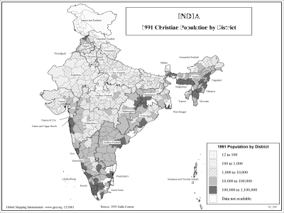
India - 1991 Christian Population by District (BW)
·Type: Maps ·Description: 1991 Chrisitian Population by district ·Map Date: 2002 ·Producer: Global Mapping International ·Collection: Reaching India (WorldVue 2002) ·Size: 8½ x 11 Inches, landscape...

India - 1991 Population by District
·Type: Maps ·Description: 1991 Population by district in India ·Map Date: 2001 ·Producer: Global Mapping International ·Collection: Reaching India (WorldVue 2002) ·Size: 8½ x 11 Inches, landscape...
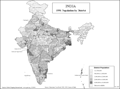
India - 1991 Population by District (BW)
·Type: Maps ·Description: 1991 Population by district in India ·Map Date: 2002 ·Producer: Global Mapping International ·Collection: Reaching India (WorldVue 2002) ·Size: 8½ x 11 Inches, landscape...
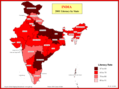
India - 2001 Literacy by State
·Type: Maps ·Description: Statewide Literacy in 2001 ·Map Date: 2001 ·Producer: Global Mapping International ·Collection: Reaching India (WorldVue 2002) ·Size: 8½ x 11 Inches, landscape...
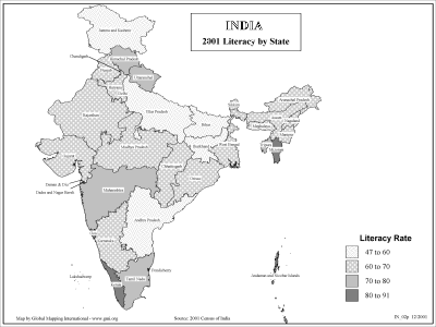
India - 2001 Literacy by State (BW)
·Type: Maps ·Description: Statewide Literacy in 2001 ·Map Date: 2002 ·Producer: Global Mapping International ·Collection: Reaching India (WorldVue 2002) ·Size: 8½ x 11 Inches, landscape...

India - Need for Church Planting and Workers
·Type: Maps ·Description: India's need for Church Planting Workers ·Map Date: 2001 ·Producer: Global Mapping International ·Collection: Reaching India (WorldVue 2002) ·Size: 8½ x 11 Inches, landscape...
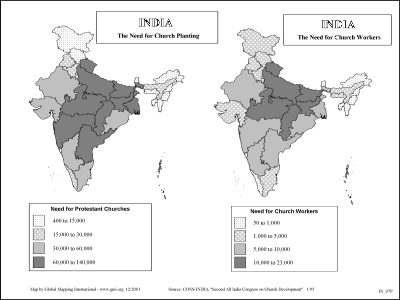
India - Need for Church Planting and Workers (BW)
·Type: Maps ·Description: India's need for Church Planting Workers ·Map Date: 2002 ·Producer: Global Mapping International ·Collection: Reaching India (WorldVue 2002) ·Size: 8½ x 11 Inches, landscape...
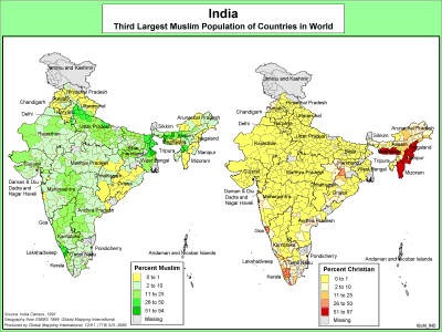
India - Third Largest Muslim Population
·Type: Maps ·Description: India's Muslim Population ·Map Date: 2000 ·Producer: Global Mapping International ·Collection: The World of Islam (WV 2002) ·Size: 8½ x 11 Inches, landscape...
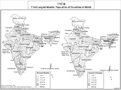
India - Third Largest Muslim Population (BW)
·Type: Maps ·Description: India's Muslim Population ·Map Date: 2002 ·Producer: Global Mapping International ·Collection: The World of Islam (WV 2002) ·Size: 8½ x 11 Inches, landscape...

India flag
·Type: Images ·Collection: World Factbook country flags ·Small size: 83 x 56 px ·Large size: 454 x 302 px ·Categories: Country :: India Collection :: World Factbook country flags Partners :: U.S. Government Topic...
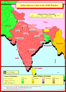
India Gateway Cities in The 10/40 Window
·Type: Maps ·Description: Gateway Cities in India to the 10/40 Window ·Map Date: 2001 ·Producer: Global Mapping International ·Collection: Reaching India (WorldVue 2002) ·Size: 8½ x 11 Inches,...
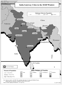
India Gateway Cities in The 10/40 Window (BW)
·Type: Maps ·Description: Gateway Cities in India to the 10/40 Window ·Map Date: 2002 ·Producer: Global Mapping International ·Collection: Reaching India (WorldVue 2002) ·Size: 8½ x 11 Inches,...
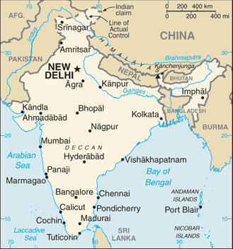
India map (World Factbook)
·Type: Maps ·Description: India (Factbook) ·Map Date: 2007 ·Producer: US Government ·Collection: World Factbook country maps ·Size: 634x323 px, landscape ·Categories: Type :: Maps Continent/Region ::...

India map (World Factbook, modified)
·Type: Maps ·Description: India (World Factbook, modified to add country name) ·Map Date: 2007 ·Producer: US Government modified by Joshua Project ·Collection: World Factbook country maps ·Size: 634x323 px,...

India Youth Population (Aged 5-19)
·Type: Maps ·Map Date: February 2009 ·Data Source: population - DevInfo India, v2, Census of India (2001) ·Producer: Global Mapping International ·Collection: Projects 2009 ·Size: 8.5 by 11 inches,...
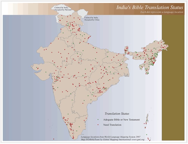
India's Bible Translation Status
·Type: Maps ·Map Date: 2006 ·Data Source: World Language Mapping System 2006 ·Producer: Global Mapping International ·Collection: Reaching India (GMMS 2007) ·Size: 8½ x 11 inches, landscape...

