Bangladesh
Bangladesh (Joshua Project)
Progress Scale: Unreached Population: 175,687,000 Capital: Dhaka % Islam: 90.29 % Professing Christian: 0.51 % Evangelical: 0.00 Peoples Count: 299 In 10/40 Window:...

Bangladesh (Operation World)
Largest Religion: Muslim Number People Groups: 326 Number Languages: 46 Official Language: Bengla; English also used For more information go to Bangladesh on the Operation World website. The above link opens in a new...

Bangladesh (Prayercast)
Government: Parliamentary Republic Major People Groups: Bengali, Bengali (Hindu), Chittagonian, Rangpuri (Rajbansi), Sylhetti Bengali GDP Per Capita: $4,800 Literacy Rate: 74.9% Unreached:...

Bangladesh (World Factbook website)
Area: 148,460 Population: 162,650,853 July 2020 est. Life Expectancy: 74.20 Net migration rate: -3.00 2020 est. GDP (real growth rate): 7.40 2017 est. Internet Users: 23,917,950 For more...
Bangladesh (WorldBank)
NOTE: The most recent year's information is shown below. Click on the year to see all years for this indicator. COMMUNICATION2022 180,198,049 Mobile cellular subscriptions2021 39 Individuals using the...

Bangladesh flag
·Type: Images ·Collection: World Factbook country flags ·Small size: 90 x 54 px ·Large size: 503 x 302 px ·Categories: Collection :: World Factbook country flags Country :: Bangladesh Partners :: U.S. Government...

Bangladesh map (World Factbook)
·Type: Maps ·Description: Bangladesh (Factbook) ·Map Date: 2007 ·Producer: US Government ·Collection: World Factbook country maps ·Size: 328x353 px, portrait ·Categories: Type :: Maps...

Bangladesh map (World Factbook, modified)
·Type: Maps ·Description: Bangladesh (World Factbook, modified to add country name) ·Map Date: 2007 ·Producer: US Government modified by Joshua Project ·Collection: World Factbook country maps ·Size:...
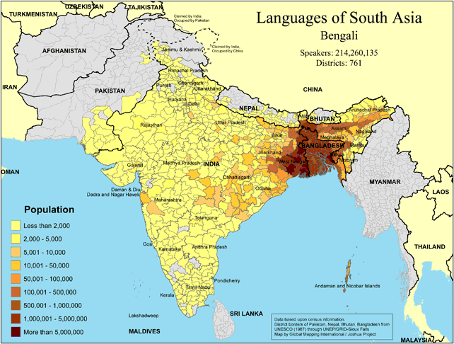
Languages of South Asia - Bengali
·Type: Maps ·Map Date: 2018 ·Data Source: Omid, based on census information ·Partners: OMID 2018 ·Size: 8.27 by 11.69 inches, landscape ·Categories: Type :: Maps Continent/Region :: Asia Country ::...

Languages of South Asia - Bhojpuri
·Type: Maps ·Map Date: 2018 ·Data Source: Omid, based on census information ·Partners: OMID 2018 ·Size: 8.27 by 11.69 inches, landscape ·Categories: Type :: Maps Continent/Region :: Asia Country :: India...
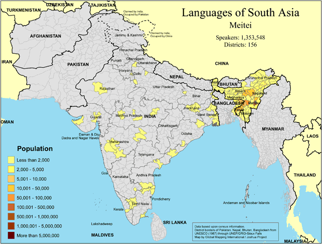
Languages of South Asia - Meitei
·Type: Maps ·Map Date: 2018 ·Data Source: Omid, based on census information ·Partners: OMID 2018 ·Size: 8.27 by 11.69 inches, landscape ·Categories: Type :: Maps Continent/Region :: Asia Country :: India...

Languages of South Asia - Nepali
·Type: Maps ·Map Date: 2018 ·Data Source: Omid, based on census information ·Partners: OMID 2018 ·Size: 8.27 by 11.69 inches, landscape ·Categories: Type :: Maps Continent/Region :: Asia Country :: Nepal...
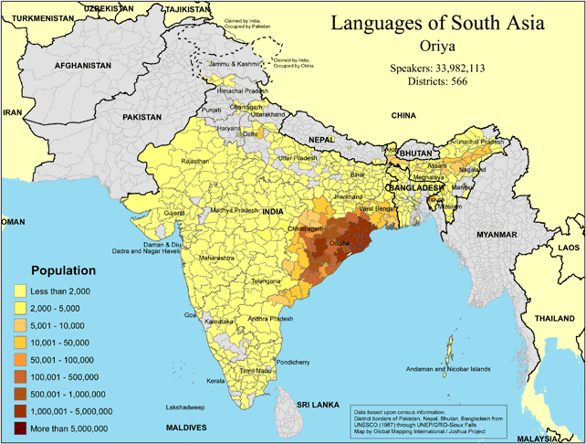
Languages of South Asia - Oriya
·Type: Maps ·Map Date: 2018 ·Data Source: Omid, based on census information ·Partners: OMID 2018 ·Size: 8.27 by 11.69 inches, landscape ·Categories: Type :: Maps Continent/Region :: Asia Country :: India...

Languages of South Asia - Panjabi
·Type: Maps ·Map Date: 2018 ·Data Source: Omid, based on census information ·Partners: OMID 2018 ·Size: 8.27 by 11.69 inches, landscape ·Categories: Type :: Maps Continent/Region :: Asia Country :: Pakistan...
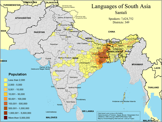
Languages of South Asia - Santali
·Type: Maps ·Map Date: 2018 ·Data Source: Omid, based on census information ·Partners: OMID 2018 ·Size: 8.27 by 11.69 inches, landscape ·Categories: Type :: Maps Continent/Region :: Asia Country :: India...
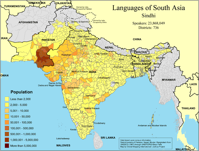
Languages of South Asia - Sindhi
·Type: Maps ·Map Date: 2018 ·Data Source: Omid, based on census information ·Partners: OMID 2018 ·Size: 8.27 by 11.69 inches, landscape ·Categories: Type :: Maps Continent/Region :: Asia Country :: Pakistan...

Languages of South Asia - Tamil
·Type: Maps ·Map Date: 2018 ·Data Source: Omid, based on census information ·Partners: OMID 2018 ·Size: 8.27 by 11.69 inches, landscape ·Categories: Type :: Maps Continent/Region :: Asia Country :: India...

Languages of South Asia - Urdu
·Type: Maps ·Map Date: 2018 ·Data Source: Omid, based on census information ·Partners: OMID 2018 ·Size: 8.27 by 11.69 inches, landscape ·Categories: Type :: Maps Continent/Region :: Asia Country :: Pakistan...

Languages of South Asia- Banjari
·Type: Maps ·Map Date: February 2008 ·Data Source: Census Information, UNESCO (1987) through UNEP/GRID-Sioux Falls ·Producer: Global Mapping International and The Joshua Project ·Size: 11.7 by 8.27 inches,...

Languages of South Asia- Bengali
·Type: Maps ·Map Date: February 2008 ·Data Source: Census Information, UNESCO (1987) through UNEP/GRID-Sioux Falls ·Producer: Global Mapping International and The Joshua Project ·Size: 11.7 by 8.27 inches,...

Languages of South Asia- Bhojpuri
·Type: Maps ·Map Date: February 2008 ·Data Source: Census Information, UNESCO (1987) through UNEP/GRID-Sioux Falls ·Producer: Global Mapping International and The Joshua Project ·Size: 11.7 by 8.27 inches,...

Languages of South Asia- Gujarati
·Type: Maps ·Map Date: February 2008 ·Data Source: Census Information, UNESCO (1987) through UNEP/GRID-Sioux Falls ·Producer: Global Mapping International and The Joshua Project ·Size: 11.7 by 8.27 inches,...

Languages of South Asia- Hindi
·Type: Maps ·Map Date: February 2008 ·Data Source: Census Information, UNESCO (1987) through UNEP/GRID-Sioux Falls ·Producer: Global Mapping International and The Joshua Project ·Size: 11.7 by 8.27 inches,...

Languages of South Asia- Kashmiri
·Type: Maps ·Map Date: February 2008 ·Data Source: Census Information, UNESCO (1987) through UNEP/GRID-Sioux Falls ·Producer: Global Mapping International and The Joshua Project ·Size: 11.7 by 8.27 inches,...

Languages of South Asia- Koch Borok
·Type: Maps ·Map Date: February 2008 ·Data Source: Census Information, UNESCO (1987) through UNEP/GRID-Sioux Falls ·Producer: Global Mapping International and The Joshua Project ·Size: 11.7 by 8.27 inches,...

Languages of South Asia- Maithili
·Type: Maps ·Map Date: February 2008 ·Data Source: Census Information, UNESCO (1987) through UNEP/GRID-Sioux Falls ·Producer: Global Mapping International and The Joshua Project ·Size: 11.7 by 8.27 inches,...

Languages of South Asia- Marathi
·Type: Maps ·Map Date: February 2008 ·Data Source: Census Information, UNESCO (1987) through UNEP/GRID-Sioux Falls ·Producer: Global Mapping International and The Joshua Project ·Size: 11.7 by 8.27 inches,...

Languages of South Asia- Meitei
·Type: Maps ·Map Date: February 2008 ·Data Source: Census Information, UNESCO (1987) through UNEP/GRID-Sioux Falls ·Producer: Global Mapping International and The Joshua Project ·Size: 11.7 by 8.27 inches,...
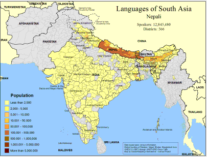
Languages of South Asia- Nepali
·Type: Maps ·Map Date: February 2008 ·Data Source: Census Information, UNESCO (1987) through UNEP/GRID-Sioux Falls ·Producer: Global Mapping International and The Joshua Project ·Size: 11.7 by 8.27 inches,...
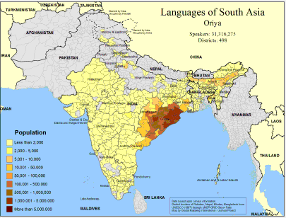
Languages of South Asia- Oriya
·Type: Maps ·Map Date: February 2008 ·Data Source: Census Information, UNESCO (1987) through UNEP/GRID-Sioux Falls ·Producer: Global Mapping International and The Joshua Project ·Size: 11.7 by 8.27 inches,...

