Reaching India (WorldVue 2002)
Includes black and white versions of maps.
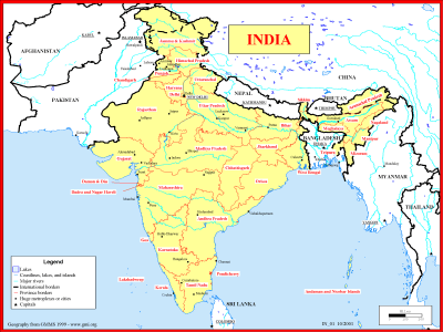
Basemap of India
·Type: Maps ·Description: Political map of India ·Map Date: 1999 ·Producer: Global Mapping International ·Collection: Reaching India (WorldVue 2002) ·Size: 8½ x 11 Inches, landscape ·Note:...
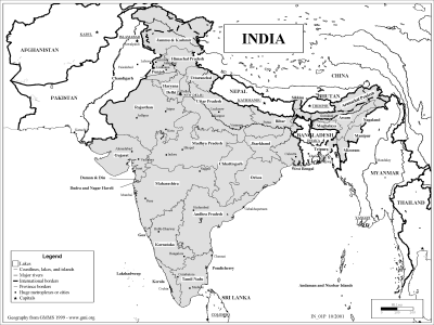
Basemap of India (BW)
·Type: Maps ·Description: Political map of India ·Map Date: 2002 ·Producer: Global Mapping International ·Collection: Reaching India (WorldVue 2002) ·Size: 8½ x 11 Inches, landscape ·Note:...
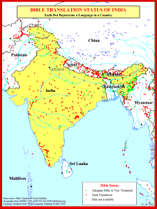
Bible Translation Status of India
·Type: Maps ·Description: Bible Translations of India ·Map Date: 1991 ·Producer: Global Mapping International ·Collection: Reaching India (WorldVue 2002) ·Size: 8½ x 11 Inches, portrait ·Note:...

Bible Translation Status of India (BW)
·Type: Maps ·Description: Bible Translations of India ·Map Date: 2002 ·Producer: Global Mapping International ·Collection: Reaching India (WorldVue 2002) ·Size: 8½ x 11 Inches, portrait ·Note:...
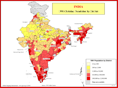
India - 1991 Christian Population by District
·Type: Maps ·Description: 1991 Chrisitian Population by district ·Map Date: 2001 ·Producer: Global Mapping International ·Collection: Reaching India (WorldVue 2002) ·Size: 8½ x 11 Inches, landscape...
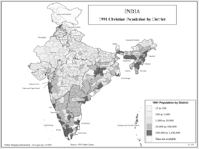
India - 1991 Christian Population by District (BW)
·Type: Maps ·Description: 1991 Chrisitian Population by district ·Map Date: 2002 ·Producer: Global Mapping International ·Collection: Reaching India (WorldVue 2002) ·Size: 8½ x 11 Inches, landscape...

India - 1991 Population by District
·Type: Maps ·Description: 1991 Population by district in India ·Map Date: 2001 ·Producer: Global Mapping International ·Collection: Reaching India (WorldVue 2002) ·Size: 8½ x 11 Inches, landscape...
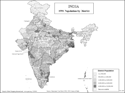
India - 1991 Population by District (BW)
·Type: Maps ·Description: 1991 Population by district in India ·Map Date: 2002 ·Producer: Global Mapping International ·Collection: Reaching India (WorldVue 2002) ·Size: 8½ x 11 Inches, landscape...
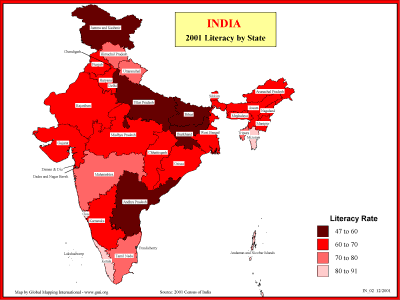
India - 2001 Literacy by State
·Type: Maps ·Description: Statewide Literacy in 2001 ·Map Date: 2001 ·Producer: Global Mapping International ·Collection: Reaching India (WorldVue 2002) ·Size: 8½ x 11 Inches, landscape...
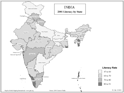
India - 2001 Literacy by State (BW)
·Type: Maps ·Description: Statewide Literacy in 2001 ·Map Date: 2002 ·Producer: Global Mapping International ·Collection: Reaching India (WorldVue 2002) ·Size: 8½ x 11 Inches, landscape...

India - Need for Church Planting and Workers
·Type: Maps ·Description: India's need for Church Planting Workers ·Map Date: 2001 ·Producer: Global Mapping International ·Collection: Reaching India (WorldVue 2002) ·Size: 8½ x 11 Inches, landscape...
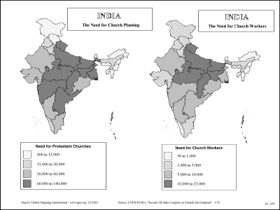
India - Need for Church Planting and Workers (BW)
·Type: Maps ·Description: India's need for Church Planting Workers ·Map Date: 2002 ·Producer: Global Mapping International ·Collection: Reaching India (WorldVue 2002) ·Size: 8½ x 11 Inches, landscape...
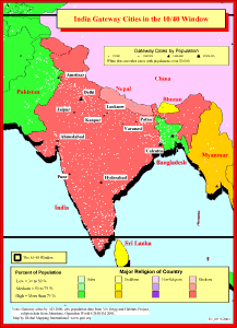
India Gateway Cities in The 10/40 Window
·Type: Maps ·Description: Gateway Cities in India to the 10/40 Window ·Map Date: 2001 ·Producer: Global Mapping International ·Collection: Reaching India (WorldVue 2002) ·Size: 8½ x 11 Inches,...
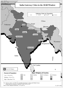
India Gateway Cities in The 10/40 Window (BW)
·Type: Maps ·Description: Gateway Cities in India to the 10/40 Window ·Map Date: 2002 ·Producer: Global Mapping International ·Collection: Reaching India (WorldVue 2002) ·Size: 8½ x 11 Inches,...

Orissa State - 1991 Christian Population by District
·Type: Maps ·Description: Christian Population of Orissa state in 1991 ·Map Date: 1999 ·Producer: Global Mapping International ·Collection: Reaching India (WorldVue 2002) ·Size: 8½ x 11 Inches,...

Orissa State - 1991 Christian Population by District (BW)
·Type: Maps ·Description: Christian Population of Orissa state in 1991 ·Map Date: 2002 ·Producer: Global Mapping International ·Collection: Reaching India (WorldVue 2002) ·Size: 8½ x 11 Inches,...

Percent Hindu and Muslim
·Type: Maps ·Description: Percent Hindu and Muslim in India ·Map Date: 2001 ·Producer: Global Mapping International ·Collection: Reaching India (WorldVue 2002) ·Size: 8½ x 11 Inches, landscape...

Percent Hindu and Muslim (BW)
·Type: Maps ·Description: Percent Hindu and Muslim in India ·Map Date: 2002 ·Producer: Global Mapping International ·Collection: Reaching India (WorldVue 2002) ·Size: 8½ x 11 Inches, landscape...

The 4,800,000 Santal People of East India
·Type: Maps ·Description: The Santal People in Eastern India ·Map Date: 1999 ·Producer: Global Mapping International ·Collection: Reaching India (WorldVue 2002) ·Size: 8½ x 11 Inches, landscape...

The 4,800,000 Santal People of East India (BW)
·Type: Maps ·Description: The Santal People in Eastern India ·Map Date: 2002 ·Producer: Global Mapping International ·Collection: Reaching India (WorldVue 2002) ·Size: 8½ x 11 Inches, landscape...

